Matlahuayl SMR | San Diego-La Jolla Underwater Park
Matlahuayl State Marine Reserve (also known as the San Diego-La Jolla Underwater Park or the San Diego-La Jolla Ecological Reserve) is one of California's beautiful marine protected areas.
Take an underwater virtual tour of this marine reserve, or keep scrolling to learn more about this special place.
Matlahuayl is a No-Take Reserve
Regulations per the California Department of Fish and Wildlife:
It is unlawful to injure, damage, take, or posses any living, geological, or cultural marine resource.
What that means:
These rules are enforced by the law enforcement division of California Department of Fish and Wildlife, and also by park rangers and lifeguards of the City of San Diego.
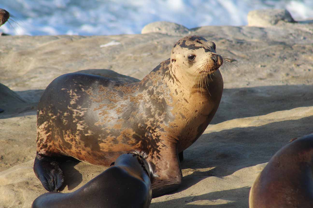
Seals and sea lions are protected by the Marine Mammal Protection Act; it's illegal to hunt, hurt, or harass these animals. The National Oceanic and Atmospheric Administration (NOAA) enforces this law and oversees investigations.
History of the San Diego-La Jolla Underwater Park
Rose Canyon Fault: The Origins of La Jolla Biodiversity
The marine life that we adore at La Jolla Cove started taking shape hundreds of thousands of years ago. The Rose Canyon Fault played a major role.
The Rose Canyon Fault runs through San Diego and enters the Pacific Ocean at La Jolla. The grinding of the continental plates uplifted ancient rock from below ground, forming the gorgeous bluffs at La Jolla Cove. The rocks that form these bluffs date back to the Cretaceous period (70 to 80 million years ago – it's the same earth that the dinosaurs walked on). The beautiful rocky reefs in Matlahuayl are growing on the rocky surfaces lifted up by the Rose Canyon Fault.
During the Ice Age, the sea level was about 400 feet lower, and La Jolla was a flat, coastal plain.
Ancient rivers emptied out onto the coastal plain. They naturally took a path through the bedrock that had been weakened and fractured by the Rose Canyon Fault (rivers tend to take the path of least resistance, through areas of brittle rock). Over time, the constant flow of water over the fractured earth eroded the bedrock and carved out La Jolla Canyon.
At the end of the Ice Age, when glaciers melted and the sea level rose, La Jolla Canyon became submerged beneath the ocean. Ocean currents pulsed upward through the canyon, delivering nutrients to the shallow coastal habitats. The canyon also provided a pathway for the vertical migration, which enhanced the food web of the entire area – you can see this in action on the virtual dive!
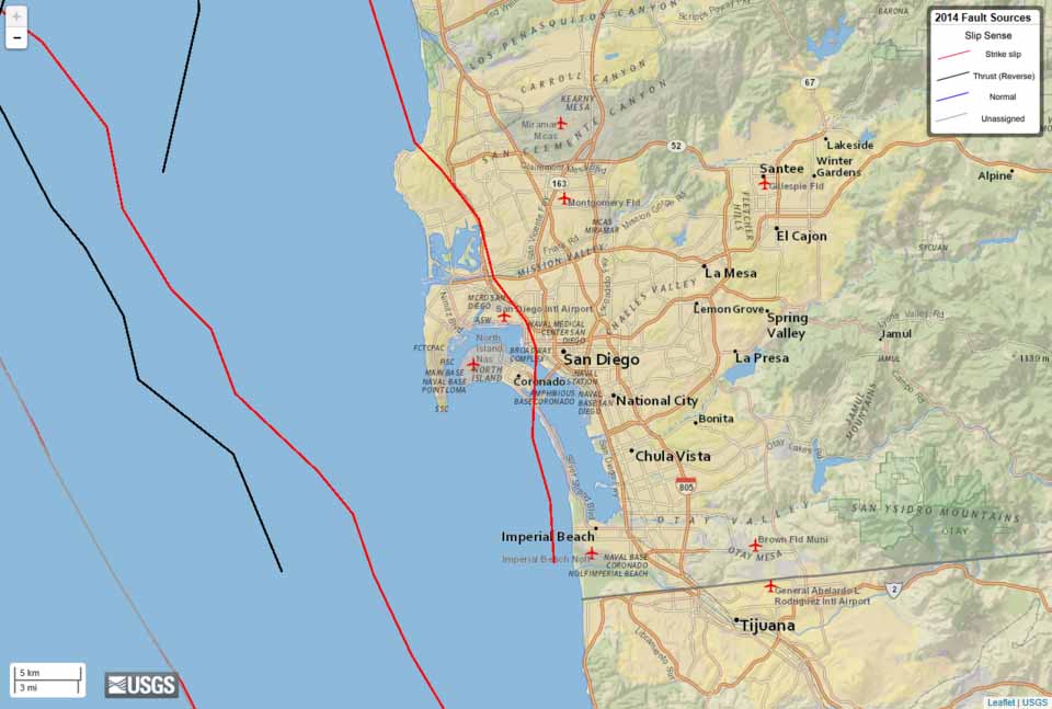
The Rose Canyon Fault in San Diego.
Source: United States Geological Survey
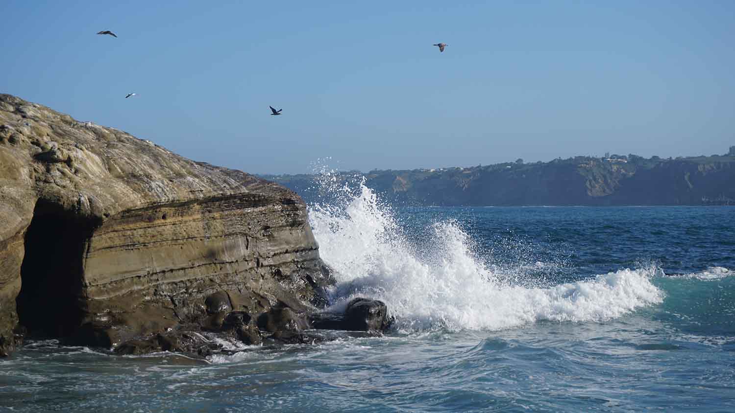
Bluffs at La Jolla Cove, uplifted by the Rose Canyon Fault.
The Kumeyaay
The Kumeyaay, and their precursors, were the first inhabitants of La Jolla. They arrived about 10,000 years ago, and formed a civilization that stretched from modern-day Oceanside down to Ensenada, Mexico.
The Kumeyaay were semi-nomadic and frequently travelled between the coastline and the Cuyamaca Mountains. They maintained an organized system of villages, territory, land rights, criminal justice, and economic activities. Deeply attuned with nature, the Kumeyaay established advanced agricultural practices and could sustainably harness food, shelter, clothing, tools, and medicine from the San Diego landscape.
When the Spanish established a settlement in 1769, the Kumeyaay endured a decades-long period of slavery, human rights abuses, disenfranchisement, and cultural genocide. Forcibly removed from the lands they had stewarded for thousands of years, the Kumeyaay found themselves separated into smaller bands, and forced to accept land on reservations that mostly excluded their original homesteads, burial grounds, and sacred sites. These reservations lacked access to water and economic opportunity, and were located far from the ocean.
To this day, the Kumeyaay continue to fight for justice and reclaim access to the coastal areas they once lived on. To learn more:
- Visit the websites of San Diego's indigenous nations, which are listed here.
- Support the work of Coastal Defenders, a local organization dedicated to restoring indigenous knowledge and coastal access.

Kumeyaay dancers, circa 1910.
San Diego-La Jolla Underwater Park
By the 1960s, the waters off La Jolla Cove and La Jolla Shores had become popular fishing spots in the community. Scuba diving, still in its infancy, was also gaining popularity.
These activities had begun to take a toll on the marine ecosystem.
Fishing boats bottom-trawled La Jolla Canyon – casting large nets and dragging them across the seabed to capture market squid. Bottom trawling had a devastating impact on the sensitive canyon walls, which were crumbling and removing vital habitat for animals. Scuba diving and freediving groups commonly took abalone, lobsters, Kumeyaay artifacts,and other marine resources.
Consequently, animal populations suffered and the loss of biodiversity became apparent at the top of the food chain. The broomtail grouper disappeared from the area, and giant sea bass were also vanishing. Abalone populations were sinking to critical levels.
A coalition of advocates (led by Scripps Institution of Oceanography scientists Jim Stewart and Conrad Limbaugh, and Harold Riley of the La Jolla Bottom Scratchers Dive Club) for the creation of a marine reserve in La Jolla.
The City of San Diego created the San Diego-La Jolla Underwater Park in 1970. The underwater park stretched from Torrey Pines all the way down to the La Jolla Sea Caves, but did not include La Jolla Cove.
But the following year, the City of San Diego added the Ecological Reserve, a "look, but don't touch" area from the sea caves to La Jolla Cove. It was San Diego's first no-take marine reserve.
To this day, many San Diegans (and tourists) still refer to the marine protected area as the "La Jolla Underwater Park."
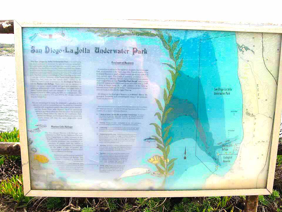
Map of the original San Diego-La Jolla Underwater Park.
Source: Ken Lund (CC-ASA-2.0)
Matlahuayl State Marine Reserve
In the 1990s, California's marine ecosystems were bending under the weight of overfishing. The California groundfish fishery collapsed, and all commercial abalone fisheries were closed as the populations became endangered. In response, California passed the Marine Life Protection Act (MLPA) in 1999.
California would create a statewide, interconnected network of marine protected areas (MPAs) to restore and sustain marine ecosystems. It would also streamline the management of all marine protected areas in the state. At the time, California MPAs were managed by a confusing mix of local governments and state agencies, with no consistent method for monitoring the health of the MPAs.
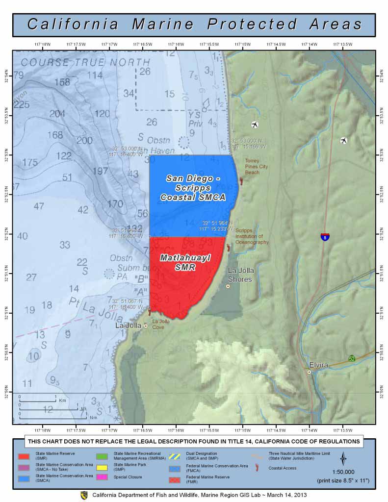
The MPA network took effect in 2012. Two marine protected areas – San Diego-Scripps Coastal State Marine Conservation Area and Matlahuayl State Marine Reserve – were established over what was once the San Diego-La Jolla Underwater Park.
Technically, the San-Diego La Jolla Underwater Park still exists, but it's superseded by the newer, state-managed MPAs. Matlahuayl is actually slightly larger than the original MPA, covering more area off La Jolla Cove.
The name "Matlahuayl" honors the Kumeyaay, who once referred to La Jolla as "Mat kulaaxuuy" (pronounced "mot-koo-luh-hoo-ee), which roughly translates to "Land of the Caves." This name was mistranslated by the Spanish as "La Jolla."
Matlahuayl is pronounced "mot-luh-who-ya-l."
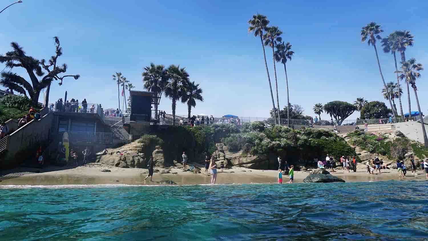
California's MPA Network
California has a network of 124 marine protected areas.
These MPAs, which span the entire coastline from Northern California to the Mexican border, are spaced about 30 to 60 miles apart from one another.
The idea is that animal populations will grow inside the MPA. These animals will reproduce and create significantly higher numbers of larvae.
The larvae will be carried away (by ocean currents) to neighboring areas, seeding the ocean with life. There's no network like this anywhere else on Earth. It's a biodiversity conveyor belt that stretches along the entire California coast.
The MPAs were created through a stakeholder-driven process. Scientists, fishermen, conservation groups, and local policymakers worked together to create MPAs that balanced the needs of conservation, fishing, and tourism.
Communities must continue working together to monitor, protect, and improve the MPAs to make sure they're delivering the highest benefits for local communities.