
Monitoring Our MPAs and Kelp Forests
Research has found that marine protected areas often have more fishes, bigger fishes, and higher biodiversity.
But how do we know that's true?
Scientists conduct underwater surveys of the MPAs and count the number of fishes. They also survey areas outside the MPA (areas with similar habitat, depth, and oceanographic conditions), which are called reference sites.
Scientists compare the data at the MPA and reference site to see how the marine communities are doing, whether there's any significant trends, and whether no-fishing regulations are responsible for those trends.
Keep scrolling to learn more about MPA surveys, how you can get involved, and what data we have on Matlahuayl.
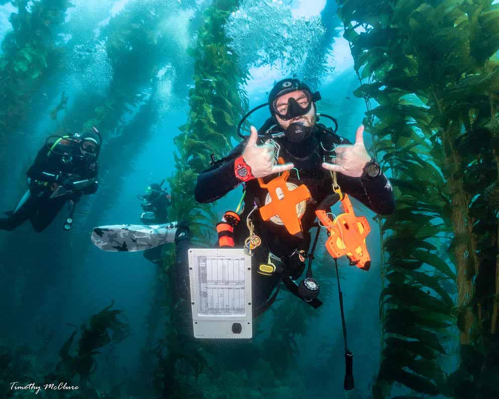
MPA Monitoring with Reef Check
Featuring Dillon Dolinar, Smith Seaweed Ecology Lab at Scripps Institution of Oceanography (UC San Diego).
"I'm Dillon. I'm a third-year PhD student at Scripps Institution of Oceanography in Dr. Jen Smith's lab, where I study kelp forest community ecology.
"Prior to Scripps, I worked at a really cool nonprofit called Reef Check, where we conducted long-term monitoring of kelp forest and rocky reef sites in Southern California.

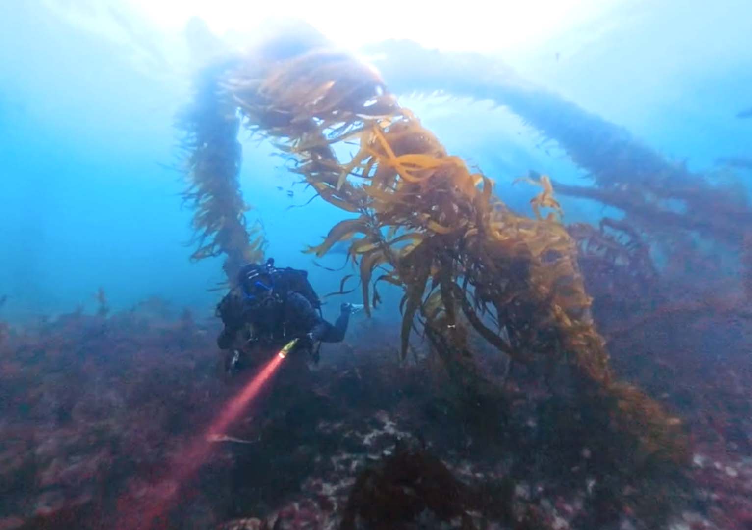
Dillon Dolinar, PhD Candidate at Scripps Institution of Oceanography.
"At a given site, there are transects – essentially measuring tapes – that are 30 meters long. We have several of these per site, at both the shallow and deeper edges of the reef.
"We can swim along the transects and take surveys of the fish, invertebrates, and macroalgae communities. These help us answer important questions about a site. How many fish are there? Are the fish big or small? Is there algae at the site? If so, what species? And so on.
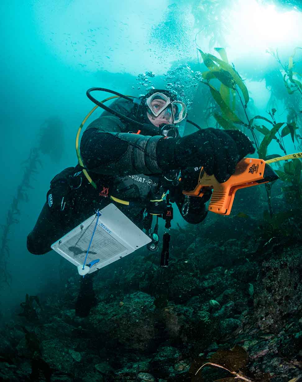
"Reference sites are really important.
"We want the MPA and reference site to be as closely comparable as possible, so the main difference is whether or not there's protection. We're not going to compare apples and oranges.
"So, if we're looking at a site within an MPA that is predominantly rocky reef, that is pretty flat, at a certain depth... we're going to find a site outside the MPA that has a similar environment. That helps us make the best comparison.
"We try to survey the MPA and reference site at the same time of year, if not the same day.
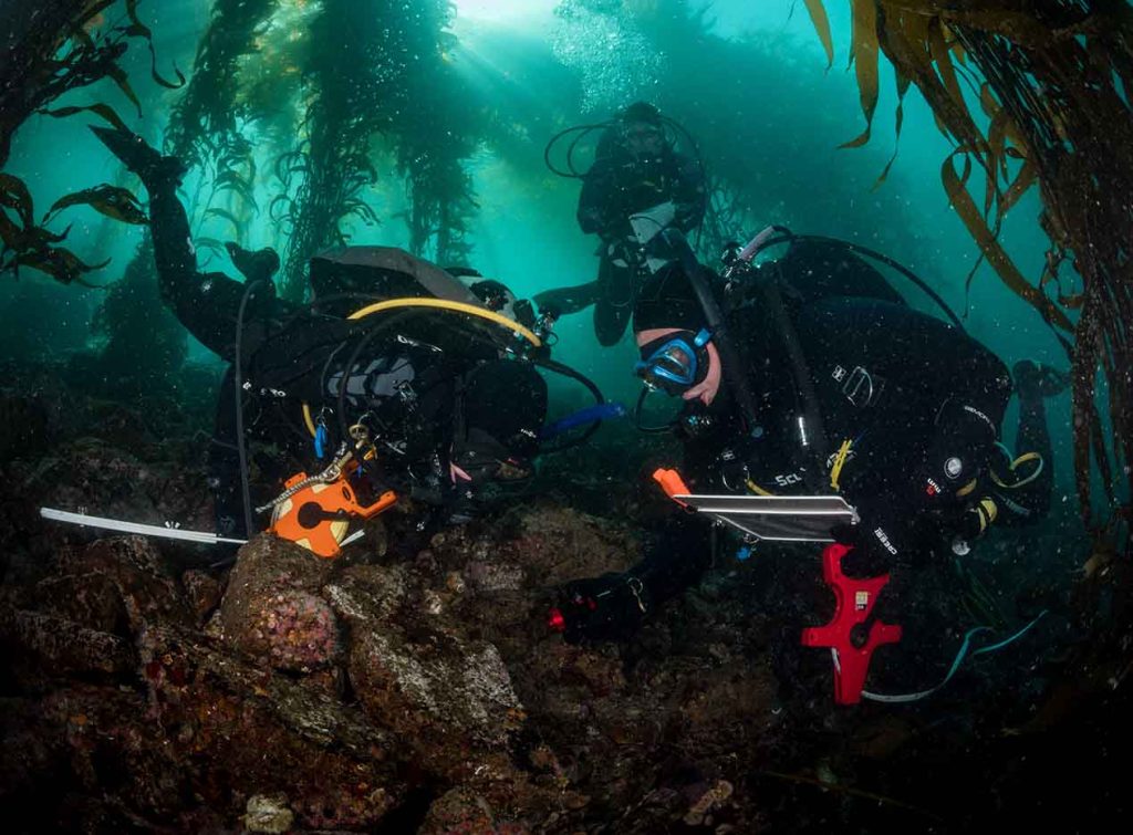
"Measuring the effects of MPAs can take a really long time. It takes roughly 6 years to see direct effects of an MPA, and about 13 years for indirect effects.
"A direct effect would be a targeted (sought-after by fishermen) species increasing in abundance inside of an MPA.
"An indirect effect would be an effect on species that are not targeted. For instance, there's a greater density of giant kelp inside the MPA because there's more predators that are able to lower the populations of kelp grazers.
The patience of the folks who are funding this type of work is really important."
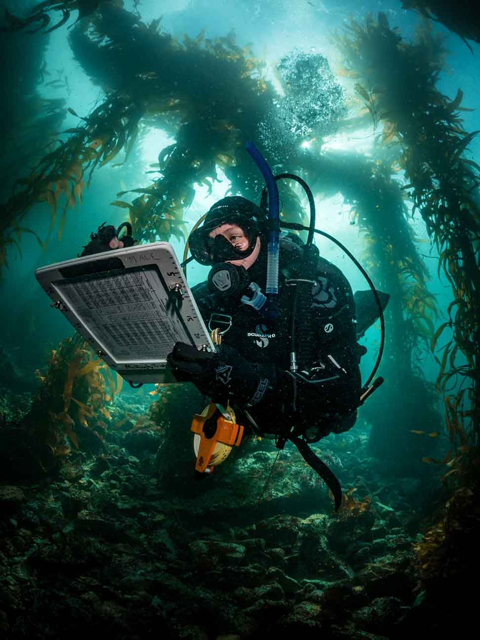
How You Can Help
MPA surveys help us track the health of our marine ecosystems, but monitoring programs are significantly underfunded. Support this important work by making a donation or becoming a citizen scientist!
Make an individual donation or Adopt-a-Reef with your organization or business.
If you're a certified scuba diver, you can train to become a citizen scientist with Reef Check and help conduct underwater surveys in your area.
Reef Check Data at Matlahuayl
Reef Check has conducted underwater surveys at this marine reserve since 2007.
Keep in mind that Reef Check does not necessarily conduct research with the data they collect. The organization mainly collects the data, which is made available to researchers who want to study the MPA and its reference sites. It's up to researchers to crunch the numbers and look for trends.
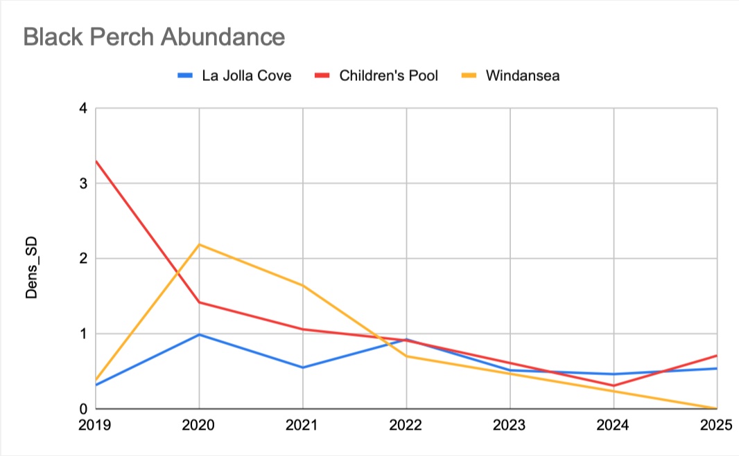
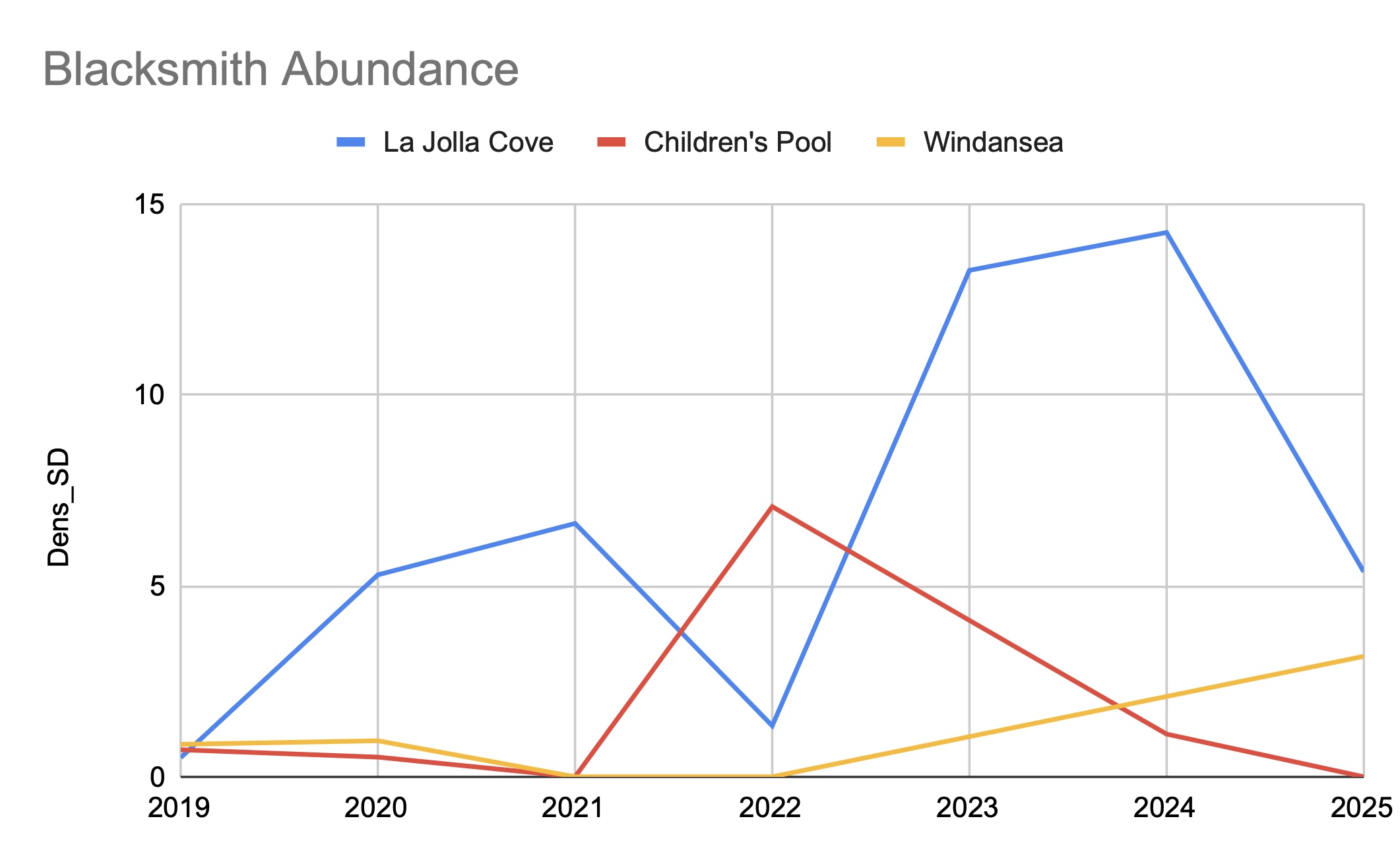
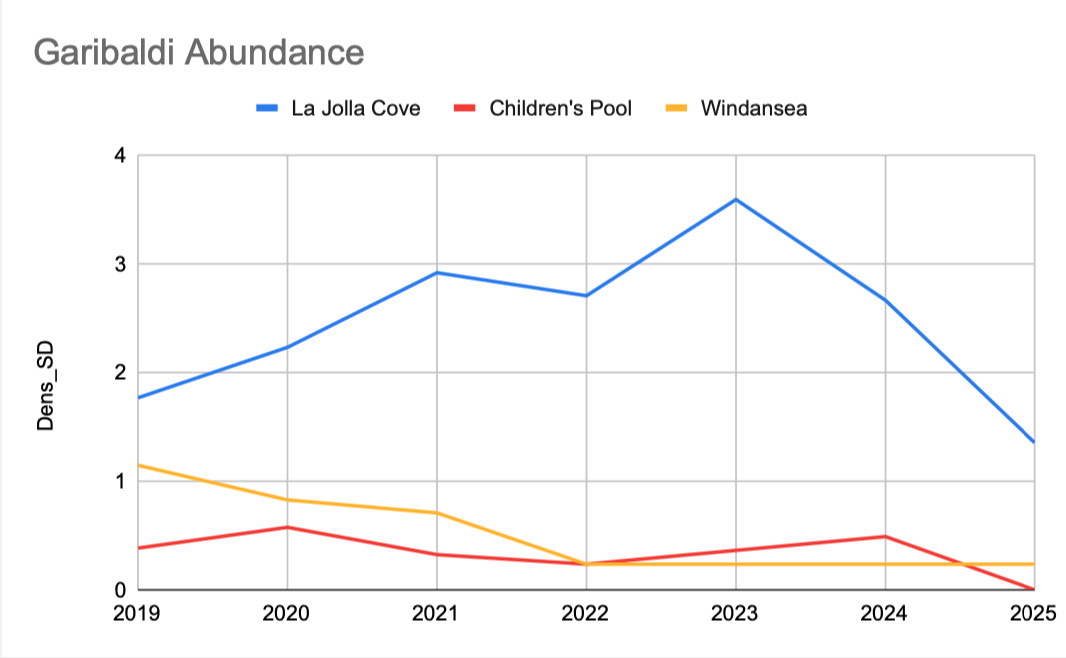
Below are a few graphs made from the data collected by Reef Check. Reef Check has already run the data through statistical error calculations.
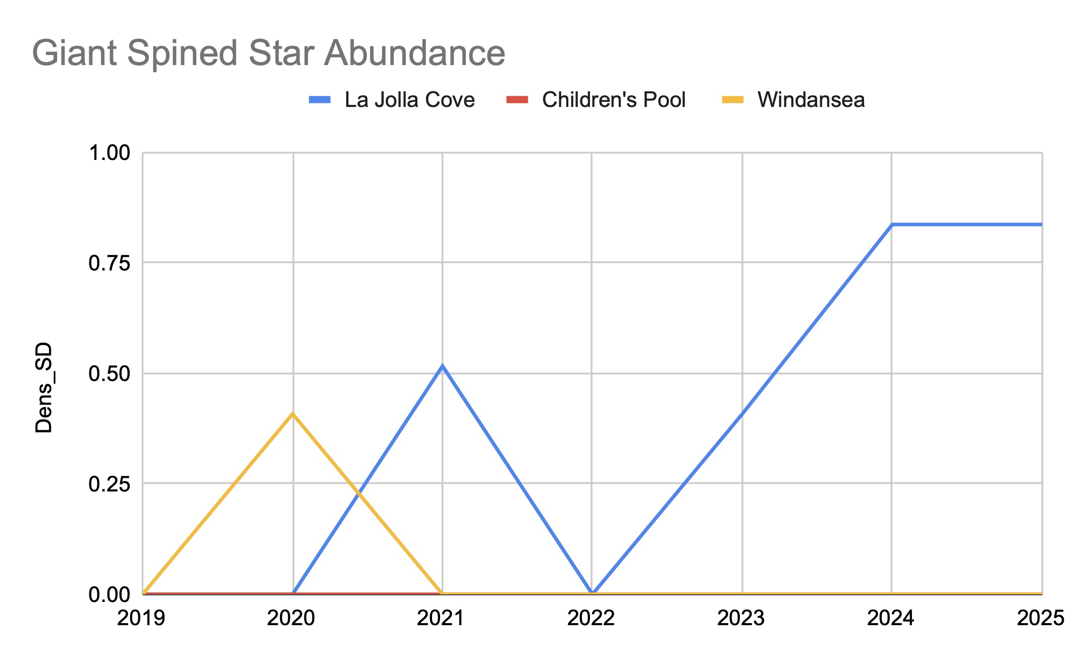
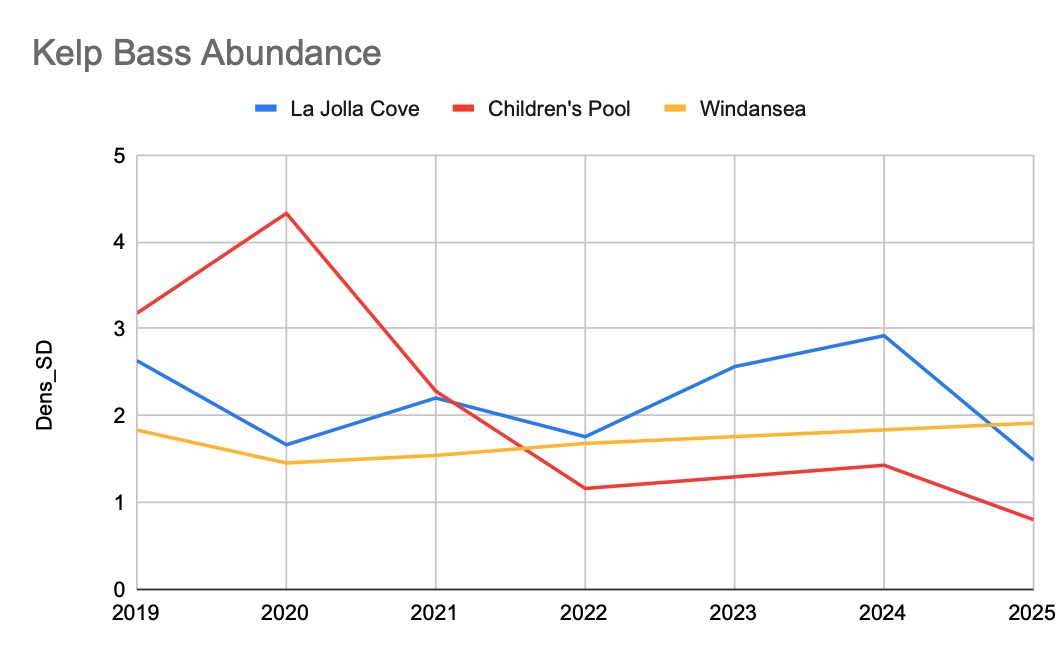
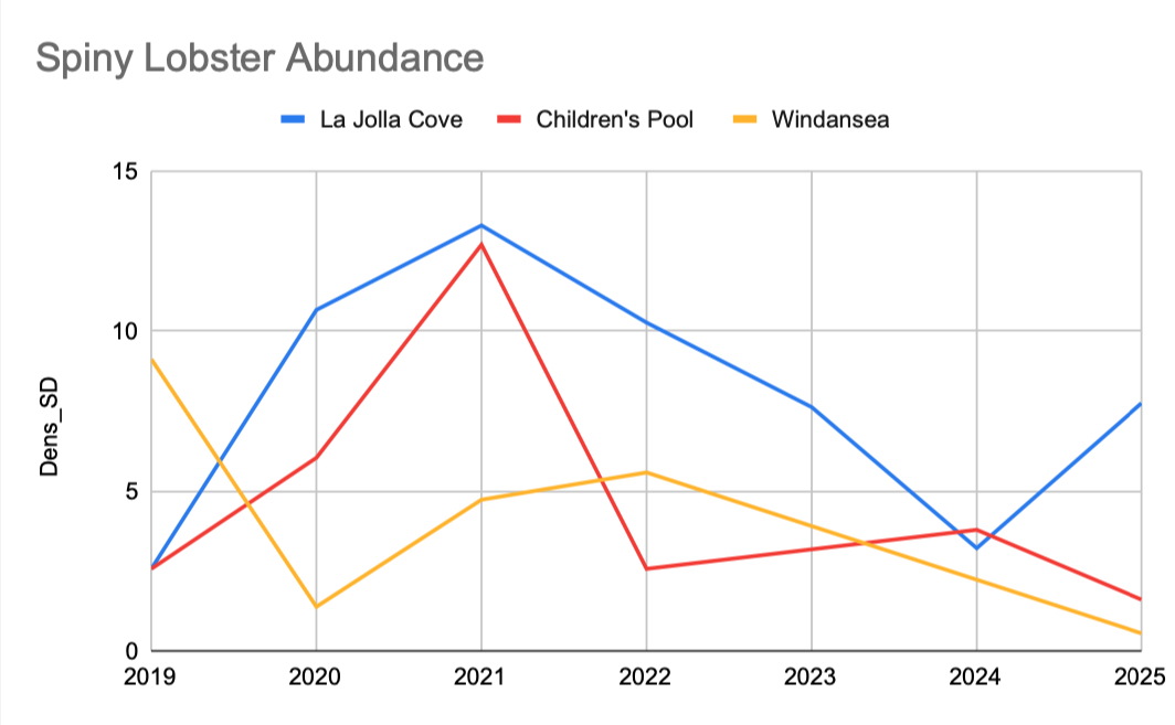
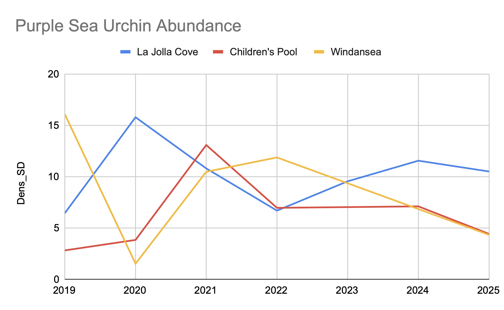
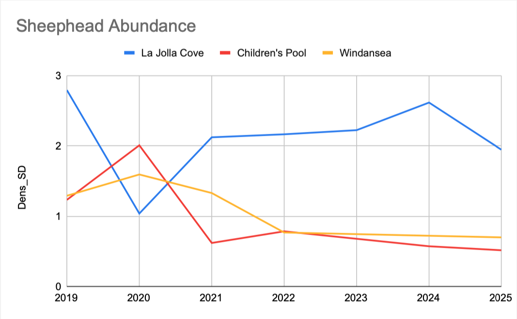
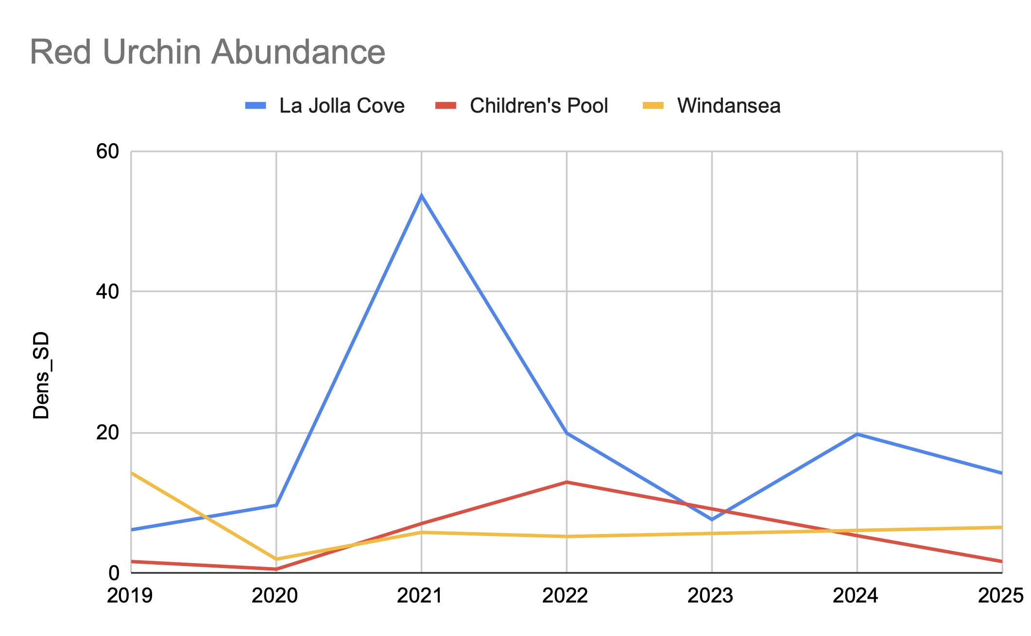
How To Read This Graph:
La Jolla Cove is the MPA.
Children's Pool and Windansea are the reference sites.
The Y axis shows the average number of species counted per 30 meter transect.
The X axis shows the year the surveys were conducted.
Researchers would not draw conclusions from this data.
They would also need to look at how much algae or substrate (seabed material) is present at each site. Then they would cross-reference that ecological data with oceanographic data, like water chemistry and sea surface temperature. Much more work is needed to understand what caused the trends you see in the graphs; collecting survey data is just the start of the process.
But hopefully this will help you understand what kind of information we're getting from underwater surveys, and how researchers can use this data to track the health of our ocean.
Because Matlahuayl is a small, undersized MPA, there hasn't been as much (recent) research done on how it's performing as a marine protected area. Researchers are much more interested in South La Jolla SMR, a larger MPA with much more giant kelp.
However, thanks to Reef Check there's plenty of data available for researchers who want to analyze the ecosystem here and how it's impacted by the no-fishing regulations.